Crooked River Track; short, stunning scenery and lots of crossings
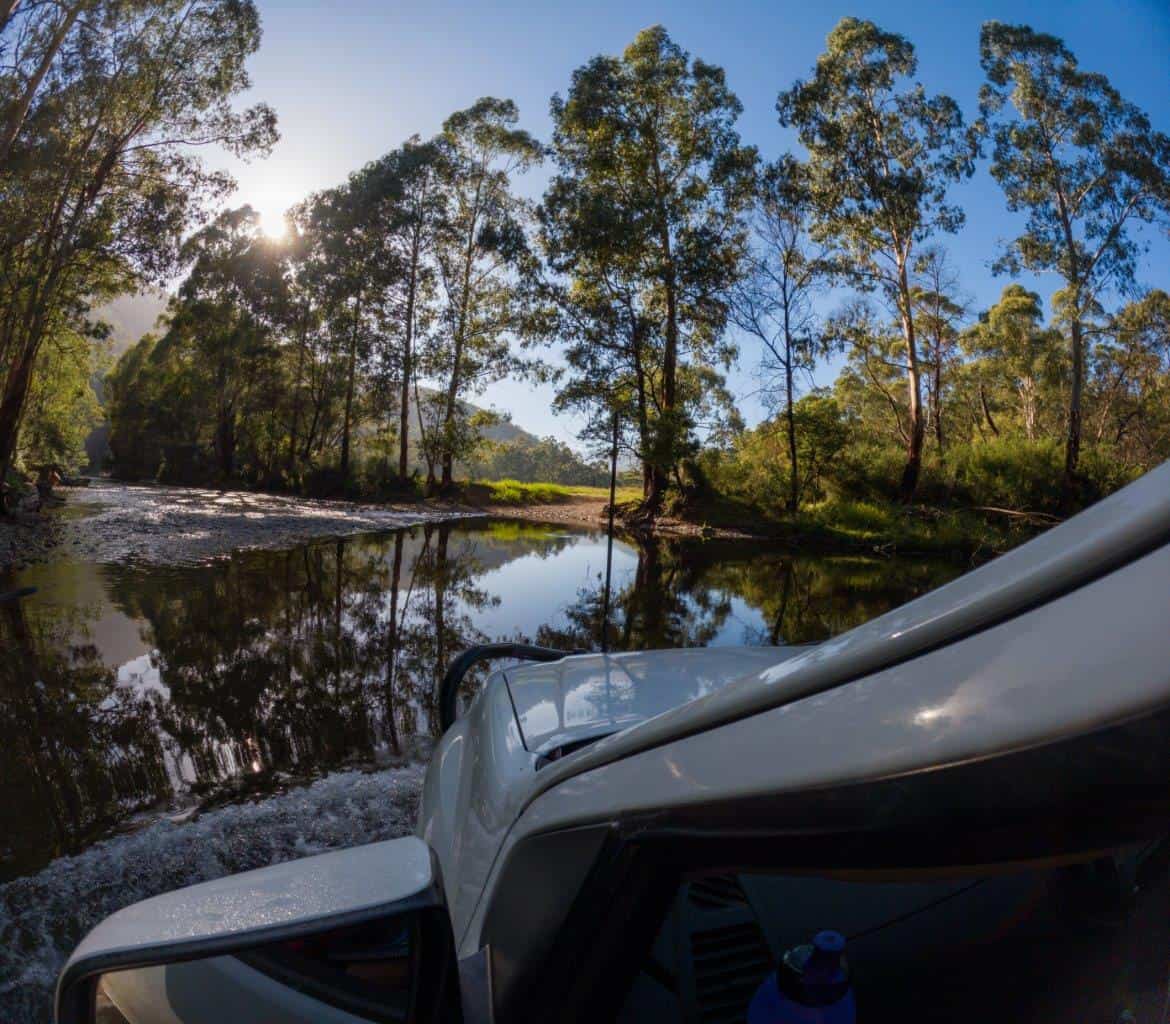
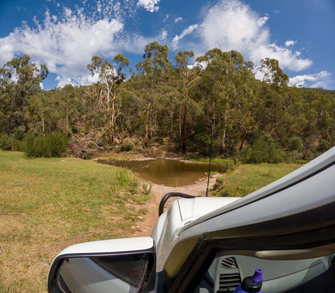
Want a stunning 4WD track that crosses a beautiful river 24 times in just under 8km? The Crooked River Track is very well known in the Victorian High Country, and is a truly ripper 4WD track. We did it whilst staying at Talbotville, and thoroughly enjoyed every minute. This track has something for everyone; its beautiful, short, has lots of easy sections and a number of more challenging sections to keep you occupied.


Where is the Crooked River track?
You’ll find this 4WD track not far West of Dargo, and quite literally follows the Crooked River. You can do it from the north to the south, or the south to the north, with Talbotville Campground being somewhat in the middle.

A lot of people combine this track into a day trip from Dargo, and do Billy Goats Bluff and then the Crooked River Track. There’s really two parts of the track though, with the easier and longer section being south of Talbotville Campground, and the more challenging section north of Talbotville.
Now, just to confuse you, there is a Crooked River Road, which you can do as part of the loop from Dargo, but its not the same thing, and a well known 4WD book calls the whole lot the Crooked River Loop.
How difficult is it?
On Newtracs, the southern part of this track is rated as easy, and I’d agree with it. It’s basically a gravel track, with a couple of river crossings, and a few smaller obstacles to navigate around. The major concern is the water levels, with some of them being about 800 – 900mm in March of 2024, and I would imagine they’d get much, much deeper after rain.

With that, comes the potential for drowning your vehicle (you absolutely need a snorkel), or worse; getting your vehicle pushed downstream. If you can’t safely walk the crossing, avoid going through.
The northern part of the track, starting at Talbotville Campground and ending at the Bulltown Spur Track, is rated as difficult on Newtracs, and it seems to get progressively more difficult as you head East.

The crossings are all fairly easy, but the exits have holes, ledges and some nasty ruts at times. Pick a good line, with some good tyres and a bit of clearance and you’re laughing, but its certainly enough to get the heart going a bit, and to make you think.


There were a few exits that I wondered if we’d struggle with, only to find with the rear locker and brand new Toyo Open Country AT3’s we just crawled up carefully, which was a relief.

How long is the Crooked River Track?
The southern section is around 10km long, with the northern section about 6.5km long, and the Bulltown spur track 3km.

How much time do you need to do the whole track?
The southern part of the Crooked River Track takes about 20 minutes to complete, from where Talbotville Road ends, to Talbotville Campground. The northern section takes about 35 minutes, and then you have to either go back along it, or drive up the spur track, which is another 10 minutes or so to McMillan Road.

What’s the scenery like?
The Crooked River is nothing short of incredible. It’s a beautiful river with rapids, trees crossing, amazing plants and wildlife, and it winds its way back and forth in a magic part of the world. We stopped at a number of the crossings just to enjoy the scenery, and much like Talbotville, and just south of there, it’s a brilliant part of the world to spend some time.

Is the Crooked River 4WD track worth doing?
I absolutely loved this track. Whilst the views of Billy Goats Bluff and then Blue Rag (which is even better) are mind blowing, there’s something sensational about following a stunning river along, crossing it dozens of times and enjoying a different part of the High Country.

If you are near Dargo, this is a must do 4WD track. It’s a heap of fun, in a wicked region.


